UNIT OF MEASURE: 1 | EA
DMI# 1432454
MFG# 000-15367-001
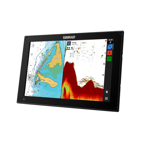
With an innovative, modern interface featuring powerful navigation capability with C-MAP support, you’ll see everything like never before. The NSX features integrated Sonar, full Radar and Autopilot systems compatibility, and with our handy Setup Wizard tool you’ll be up and running in no time. All you need to do now is choose your next adventure.
DISPLAY
Display Size , Blacklight Color: 12” with Mutli-Touch Screen, White
Display Resolution: 1280 x 800
Viewing Angles: 85° (Top, Bottom, Left and Right)
CONNECTIVITY
Bluetooth: Bluetooth 4.0 with support for Bluetooth Classic
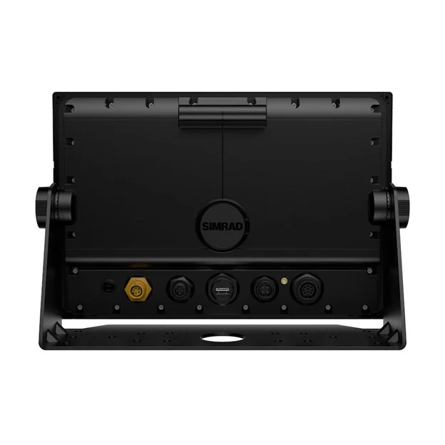
Ethernet Ports: 1 port (5-pin connector)
Connectivity Wi-Fi: IEEE 802.11b/g/n
NMEA 2000 Connectivity:1 x NMEA 2000 Micro-C port, 1 LEN
PC Connectivity: NO
SD Card Storage: 1 MicroSD slot, USB port for external drive
Video:p Camera support
MDF
AIS: Receive AIS data over NMEA 2000
Cartography Included: Discover X chart card of North America
GPS: Internal, 10Hz, WASS, MSAS, EGNOS
Sonar Compatibility:One 9 pin Xsonic 1 kW Sonar port. Single channel CHIRP, 50/200 khz, HDI Active Imaging
Waypoints, Routes, Tracks: 6000 waypoints, 500 routes with 100 max route points, 50 tracks with up to 12,000 track points
Weather: NO
GPS
Correction: 10 Hz high speed update (internal) WASS, MSAS, EGNOS, GLONASS GPS Receiver
Channels: 32 Channels
Position Accuracy: Horizontal Accuracy 3 m (9.8 ft)
Update Rate: 10 Hz
CARTOGRAPHY
Charts Supported: C-MAP Tile (CMT) Discover X C-MAP Tile (CMT) Reveal X
FEATURES:
• A new, intuitive touch screen experience.
• Crystal clear, high definition views: NSX pairs a clean and straight forward interface with high-definition visuals to deliver a whole new experience. Easily access and use all NSX features, including smart drag-and-drop screen customisation, fully editable instruments bar and enhanced day and night modes. Get crystal clear views of chart detail, structure and bottom contours with the vibrant SolarMAX IPS touchscreen – viewable from any angle, in direct sunlight, and through polarised lenses.
• Powerful C-MAP navigation capability: C-MAP DISCOVER X and REVEAL X marine-optimised charts feature a fresh, intuitive chart presentation and the latest updates. C-MAP charts include full-featured Vector Charts with Custom Depth Shading and High Resolution Bathymetry showing accurate contour lines down to a 1-foot level of detail Improve planning and route plotting with Tides and Currents projections and our fastest ever Autorouting. Plus, there’s a new Map Inspection feature with one-touch access to information on locations, POIs, tides, channels and more.
• Full Sonar, Radar and Autopilot Suite.
• Expand your System with Advanced Simrad Technology : Identify hazards with HALO pulse compression radars, stay on course with Autopilot systems and experience a range of integrated Sonar. Get highresolution images 300 feet below and 300 feet to the sides of your vessel with Active Imaging 3-in-1, featuring all your sonar – CHIRP, DownScan Imaging and SideScan – from a single transducer. For superior clarity and the highest resolution images at a longer range than any other structure imaging technology. FishReveal Smart Target View provides even easier target identification with clearly defined fish arches. You can even search greater depths with a wide range of compatible 1kW transducers.
• Easy-to-use Setup Wizard.
• Life on the water is easier than ever beautiful : With everything from a Setup Wizard to Simrad App
integration, you’ll be up and running in no time. The Setup Wizard helps with step-by-step instructions to get you up and running quickly, while the Simrad App offers a whole host of added extras. These include hassle-free software updates, on and off the water trip planning, a streamlined chart display that looks the same across all platforms, plus easy transfer of all data, including routes and waypoints










There are no reviews yet.